With nearly 20 years’ experience providing both online and offline maps, the Czech company Seznam.cz has developed an international app enabling all tourists, cyclists, kiters, and travelers to explore the whole world with a single app in their phone. Windy Maps provides the most detailed maps available, with a mission to offer tourists all the information they need about their chosen location, even away from an Internet connection. Thus, with no Internet, one can still find the closest bus stop, see when the next bus leaves or, for example, plan a biking trip in the nearby mountains. The app is available for free at Google Play Store as well as in AppStore in English for now, with other languages to follow soon.
Detailed and reliable offline maps
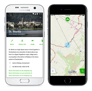
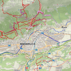
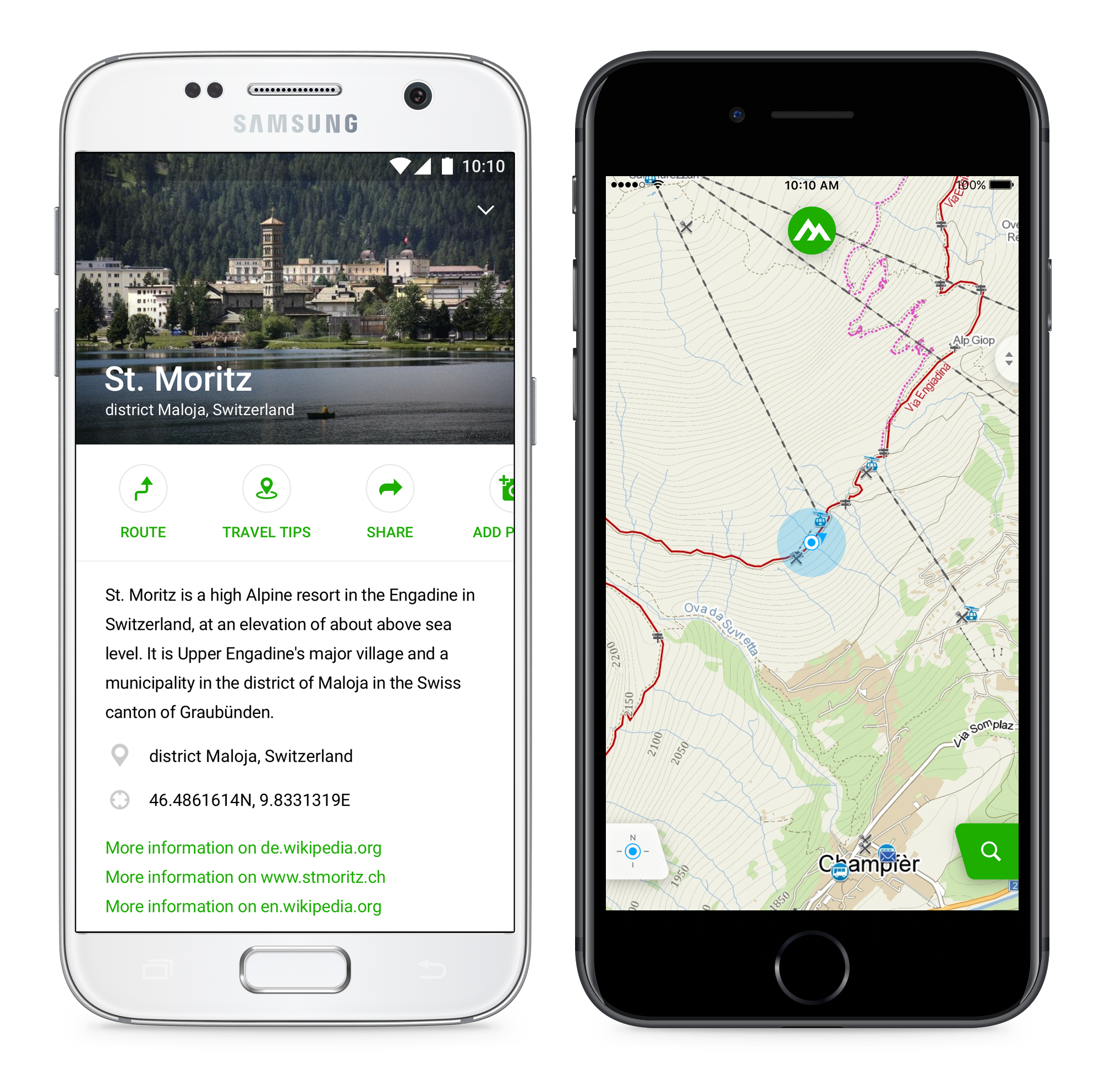
Windy Maps offers maps of the whole world with a focus on tourist information. Based on Open Street Map (OSM) data, additional information sources such as Wikipedia, open data on public transport, and data from private companies (such as Booking.com, whose data will appear in the app soon), Windy Maps is ready to be a reliable partner for any trip – worldwide. Windy Maps is designed to help active tourists make the best of their trips. Thus, it includes not only detailed topographic data presented through an easy to read map key, but also other information you might need on your trip. This includes information about sights and interesting places (using, for instance, Wikipedia data), tips for places to visit, and useful information about the nearest public transport stops and scheduled departures if available in open data format at the given location. All this information is available at hand and yet presented in an easy to read way.
Maps of the whole world can be downloaded to your mobile phone. There is no need to download the whole world at once – you can choose only the country you live in or one you plan to visit. If your phone does not have the capacity to hold a whole country map, you can even download just a specific area. Once the maps are downloaded to your phone, they will not only work offline but will also enable offline search, trip planning, and navigation. All this is available free of charge.
Navigation with no Internet connection
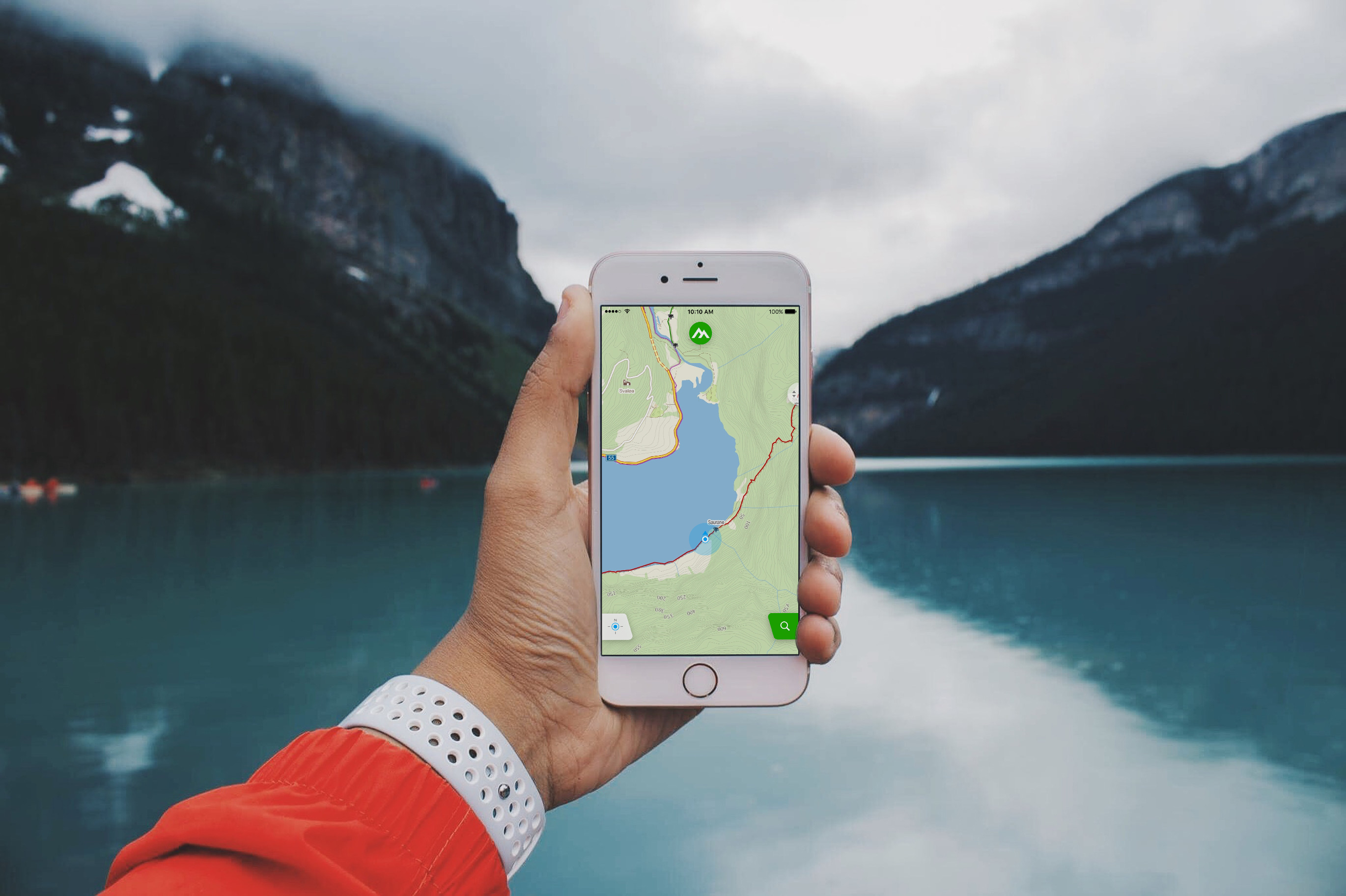
Windy Maps will help you feel at home even in places you are visiting for the first time. It will find the closest accommodation to the beach, the station, or the airport. It will show you the nearest restaurant, and will help you find an interesting place to visit the next day. People who enjoy hiking or just walking will find that Windy Maps can recommend routes to suit them (for hikers or walkers). It just takes one click and a choice of preference. The recommended route can be easily altered – you simply extend or shorten it on a time scale represented by a simple bar. You can also see the profile of your route, so you will know how much elevation is involved. The route is then automatically altered to suit you. All you need to do is let Windy Maps help you discover new places, paths, and opportunities to explore. The same applies to cyclists and drivers. Cyclists can choose if they want to ride on roads or away from them, drivers if they want to take a shorter or faster route.
Windy Maps does not only plan the trip for you, it can also navigate you– whether you go on foot, by bike, or by car. Navigation works offline with downloaded maps, and so does search, very practical if you decide you need to shorten or want to extend your route when already on the way. The only reason you might need your Internet connection with Windy Maps is to share your route on Facebook or to send photos to the cartographic team at Seznam.cz to share your picture with other tourists going to the same location.
To find out more about Windy Maps or to download the app, please visit windymaps.com.
Windy Maps uses map data from OSM data, Wikipedia, and Wikidata. This applies to maps of the whole world, except the Czech Republic and Slovakia, where Seznam.cz uses its own cartographic data and information on restaurants, companies, public transport stops, etc. We should add that this is because Seznam.cz has run its own online map portal since 1998, and has been building its online tourist maps and its own database for the last nearly twenty years to provide the most detailed tourist maps of the Czech Republic and Slovakia you can find. Let us add that the desktop maps (Mapy.cz) run by Seznam.cz are used by about 500 000 people every day and 3.5 million people every month, or nearly the half the online Czech population (see Netmonitor.cz).
Seznam.cz has also offered a mobile phone map app (Mapy.cz) concentrating on tourists and their trips for nearly six years. It is the most popular app for maps in the Czech Republic, and used by about 200 000 people every day, with more than 1.2 million active users (approximately 1/5 of the online Czech population).
This is the experience Seznam.cz has applied to Windy Maps. Seznam.cz knows how much people appreciate detailed information on the sites, routes, paths etc. they visit. It also knows that these details and all the topographic data need to be presented in a simple way so they are easy to use. Windy Maps uses all this information and goes one step further, with most app functions usable with one hand.
Seznam.cz, the number one Czech on-line company combining a media house and technological company, has released a specialised tourist map of the whole world on its portal Mapy.cz. The map includes information on hiking and cycling trails that will benefit virtually any active tourist. The tourist map of the world is available on-line and will …
In My Mapy, you can now search across all your saved routes, places, gpx files, or activities. The search works on your computer and mobile – even in offline mode.
In the route planner and navigation for pedestrians and cyclists, you will now find warnings about difficult sections. So that you always know in advance whether there are passages along the way that could be beyond your abilities.


