Go to contents

#Mapy.com


18. November 2026

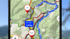
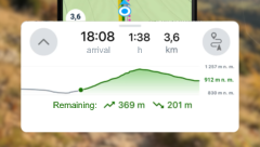
In Mapy.com, you can now see the elevation profile not only when planning a route, but also during navigation. That way, you immediately know where climbs or descents await you. When walking and cycling, it displays automatically; when driving, you can easily turn it on.
18. November 2026

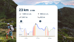
You can now find the elevation profile below the map on the web and in the planned route details in the app. It uses colors to show the gradient, path type, and surface of individual sections.


6. November 2026

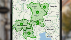
Downloaded offline maps now update automatically. You will have new hiking trails and cycle paths at hand without having to check for updates.


Ondřej Musil 20. August 2026

In Mapy.com, you will now find a denser network of hiking trails in Austria – roughly 145 thousand kilometers of routes instead of the original 95 thousand. You can thus plan your trips to our neighbors with even greater confidence.


Ondřej Musil 30. July 2026

With the new PRO Route Planner feature, you can edit your planned route by drawing with your finger directly on the map. The feature is part of Mapy.com Premium, you can try it 5 times for free.


Ondřej Musil 17. June 2026

In My Mapy, you can now search across all your saved routes, places, gpx files, or activities. The search works on your computer and mobile – even in offline mode.